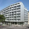
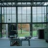
This region is home to Saint-Étienne, a major legacy of industrial buildings (special objects, installations and infrastructures). These buildings and infrastructure objects, hardly a presence in the cultural consciousness, form a strong symbolic and spatial potential for regional development.
Through an economic restructuring and the consequent increase of brownfield sites the heritage in local collective consciousness was hardly available. Therefore its preservation was endangered and the integration in a symbolic, social, cultural or economic system was left to chance.
LIA proposed in this context, to create an Atlas that portrays the places and objects first and puts them in a new context. This visualization was the first step for a new interpretation and revitalization. In the summer semester of 2006 an elective seminar was organized with the students of the TU Berlin and an Atlas was created. It was a cross collaborative effort through teaching and research methods.
Simultaneously in the 'Biennale Internationale du Design' in Saint-Étienne in December 2006 a publication about the Atlas was presented that summarized the results along with the texts from LIA, economists, sociologists and architectural historians.
Atlas Actif
Saint-Étienne
The “Atlas Actif” is a method of analysis and documentation at a particular location represents its goal in the existent and invisible-existing landscape elements and special constructions-visible again and highlights the potential present in the region.
The atlas recorded and transcribed the elements and potential to restructure the region. It does not include planning; it is merely a basis for the redesign of the existing and future developments by the industrial heritage visible and understandable. By linking the information obtained with the existing cartography of the Atlas can quickly become an instrument of active communication.
The atlas was designed to be an accurate and readable document. It does not require specific knowledge, since it appeals to a variety of actors from different areas. The data in it contains representations and form a tool for open planning across the municipal and regional boundaries.
The Atlas was developed in two phases:
Phase1: A schematic three-dimensional portrayal of industrial buildings, infrastructure and equipment in two scales. Here is a cataloged collection of comparable data and draughtmanship and photographic representations of the industrial heritage has been created.
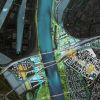
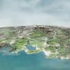
Phase 2: A portrayal of the spatial context of objects and systems as well as an analysis of the region as a whole by means of a standardized cartography and an innovative iconographic representation.
Area-01-ALO
Area-02-CRG
Area-01-CRG Micro
Micro-CRG-01
Microlevel-CRG
Area-03-CSE
Area-04-FUF
FUF 02
FUF 02
Area-05-GSC
Microlevel-GSC
Microlevel-02-GSC 01
GSC 01
GSC 02
GSC 02
Area-06-PLH
Project Data
Program: Atlas indexing and classifying the various unused factories sites of the valleys of Saint-Étienne, in order to give them a better visibility, to facilitate future developments.
Client: DDE; Epora, Saint-Étienne
Status: 2006-2008
Location: Vallées Stéphanoises
Surface: 176,000 m²
Team
Architects: LIA, Finn Geipel, Heiko Walth, Richard Woditsch, John Klepel, Philip Rieseberg, Wilhelm Klauser, Bill Klauser; Credits: Frederic Fourrichon, Sylvain Neel; Photography: Anja Bauer, Dimitra Dantsiou, Ines Isidoro, Katharina Janowski, David Kaufmann, John Klepel, Sebastian Kroeker, Marcin Krolik, Jan Meersmann, Daniel Reckmann, Rosie van der Schans, Heiko Walth, Richard Woditsch


